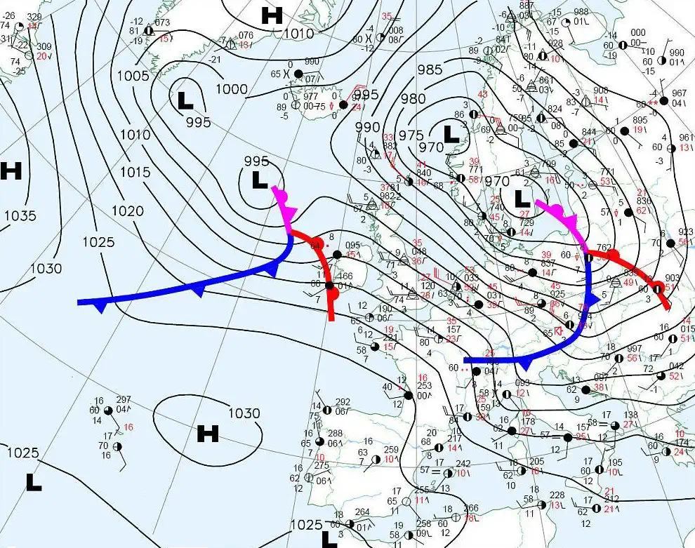
Weather maps

Weather maps contain a lot of information about the recent weather conditions. They contain data on temperature, wind strength, wind direction, air pressure changes, precipitation, cloud type, population density, low-lying clouds, such as fog and the dew point (humidity).
Interpretation of weather maps
On a weather map, lines connect points of equal pressure. These lines are also called isobars. The law of Buys Ballot immediately indicates where the wind comes from: “With the wind in the back, the high pressure area is on the right and the low pressure area on the left.” This only applies to the northern hemisphere and for situations above 1 km altitude. Below 1 km one has to deal with the friction of the earth and the wind (on the North Sea) will get a small deviation to the right as a result of the Coriolis force.
Furthermore, heat and cold fronts can be seen. These are fronts with hot or cold air behind them and are part of low-pressure areas. There are also occluded fronts, these are fronts where the warm air has been overtaken by the cold air. On these fronts belong different types of weather types:
Heat front:
The wind increases and shrinks to the south. The air pressure decreases with increasing speed. There will be more clouds. An approaching front is announced by cirrus and cirrusstatus clouds. Then follows altostratus and nimbostratus. Subsequently, there are low-hanging clouds, this is usually stratus, but cumulus clouds can also occur with more active heat fronts. From this precipitation can fall, but never more than a few millimeters. The precipitation falls over a longer period, ranging from a few hours to full days.
Cold front:
The wind suddenly shrinks and the wind blows a lot faster, wind gusts are possible. The air pressure shows a slight increase because the temperature drops. The cold front is accompanied by Cumulonimbus clouds. This can result in a lot of precipitation. Because the slope of the cold front is much steeper than that of the heat front, the passage of the cold front will never take longer than half a day.
Occlusion Front:
With an occlusront, the cold air has overtaken the warm air. An occlusion front exhibits the same clouds as a heat front, but often has more low clouds (stratus). A small amount of precipitation can fall and the wind shrinks and attracts something.
Cloudiness can also occur in high-pressure areas. Usually low clouds, no precipitation. However, it is usually cloudless in high-pressure areas.
By looking closely at the high and low-pressure areas and when the fronts cover, one can get a good idea of the weather. East winds often produce dry air and provide high temperatures in summer and low temperatures in winter. The reverse applies to the west wind. Often warmer temperatures in winter and colder temperatures in summer. The combination of the wind direction and whether or not fronts occur and where there is high and low pressure, already gives a good picture of what is to come.
